Submitted by Donnie Gladfelter on January 2, 2013 - 2:55pm
Toposurfaces play an important role in many Autodesk Revit models, yet with topography typically coming from a civil engineer using AutoCAD Civil 3D this has oftentimes proven easier said than done. The Autodesk Subscription Extensions for Autodesk Revit 2013 introduce a wide range of new tools to Revit. Among the tools within this extension is a road and terrain tool that aims to simplify the workflow for bringing AutoCAD Civil 3D surfaces into a Revit model.

Once installed a whole range of new tools are added to an Extensions tab within Revit. With this extension installed, AutoCAD Civil 3D surfaces can be imported into Revit using the following workflow:
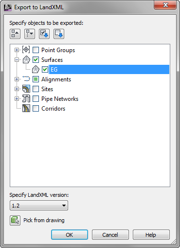
- From AutoCAD Civil 3D, export your surface as a LandXML file from the Export panel of the Output Ribbon tab. This opens the Export to LandXML dialog where you can select which Civil 3D objects should be included in the export.
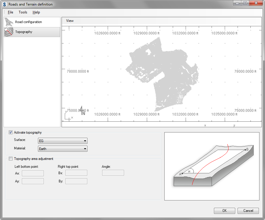
- Switching to Revit, launch the Roads and Terrain command from the Autodesk Revit Extensions panel on the Extensions Ribbon tab. This opens the Roads and Terrain definition dialog.
- Uncheck the "Import road segments" checkbox, and then click the Browse button found in the middle of the Roads and Terrain definition dialog, and browse to the LandXML file created with AutoCAD Civil 3D.
- Switch to the Topography page within the Roads and Terrain definition dialog, and do the following:
- Verify the Activate topography checkbox is selected.
- Select the desired surface (usually named EG or Existing Ground for existing, and FG or Finished Ground for proposed).
- Select the desired Revit Material (i.e. Earth or Terrain).
- Click OK when finished to close the dialog and begin the import.
The time to complete the import process will vary based on the size and complexity of the selected surface (usually under a minute). Once compete you will have a Revit Toposurface that was created directly from the surface found inside AutoCAD Civil 3D.
Since this was created from the actual surface definition instead of a topographic approximation of the surface, the net result is a higher fidelity Toposurface which is more accurate.
The Revit Extensions for Autodesk Revit 2013 are available as a free download from the Downloads > Product Enhancements page within the Autodesk Subscription Center. Read more about Build Revit Toposurfaces from AutoCAD Civil 3D Surfaces
Tags:
Autodesk Subscription,
Subscription Extensions